GPS coordinates and fishing information for Richland Chambers Lake
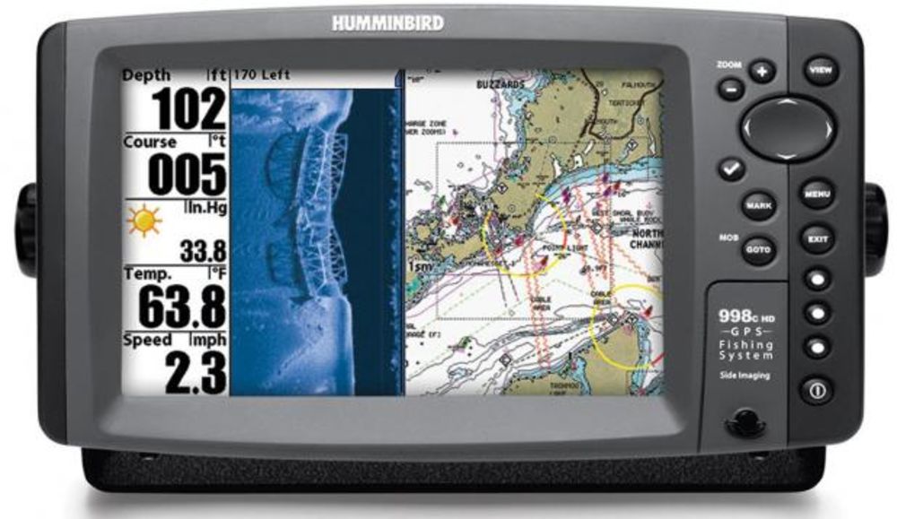
The following GPS coordinates are provided for general reference.
THEY ARE NOT TO BE USED FOR NAVIGATION
GPS Waypoints for Richland Chambers Lake:
Submitted by David A. McClung
GPS Waypoints for Richland Chambers:
Submitted by David A. McClung
GPS Waypoints are now in alphabetical order as they appear in the GPS receiver. Each entry
starts with waypoint name, then latitude/longitude, followed by date and time, and finally
a description of the waypoint. Note that the naming convention used is the first letter of
the lake name is the first letter of the waypoint. All points here are named R????? This
keeps all of the points for a particular lake together in my receiver. All lake points end
in P or PT; all creek entrances, coves, and canyon entrances end in C; and any marinas end
in M.
The GPS Waypoints are generally in the water, just off of the topographical feature
indicated. The GPS Waypoints will help you know where you are on the lake.
Extreme CAUTION should be used when navigating to the points.
USE THIS INFORMATION AT YOUR OWN RISK!
With some minor editing of this file, you should be able to upload it from your computer
directly to your GPS receiver. This saves a lot of finger poking on the receiver.
W REURKC N3201.28000 W09615.00000
12-JUL-97 07:07:59 -9999 ENT TO EUREKA CREEK 0.00000e+00 18
W RCEDRC N3202.00000 W09615.36000 12-JUL-97 07:09:35 -9999 ENT TO CEDAR
CREEK 0.00000e+00 18
W RORCHD N3203.26000 W09617.54000 12-JUL-97 07:11:55 -9999 ORCHARD S SHR
CHMBRS 0.00000e+00 18
W RELMCK N3204.34000 W09617.58000 12-JUL-97 07:13:35 -9999 ENT TO ELM
CREEK 0.00000e+00 18
W RWOODC N3204.22000 W09617.14000 12-JUL-97 07:15:05 -9999 ENT TO WOOD
CREEK 0.00000e+00 18
W RNARWC N3204.12000 W09615.02000 12-JUL-97 07:15:46 -9999 ENT TO NARROW
CREEK 0.00000e+00 18
W RTCH2O N3202.48000 W09612.49000 12-JUL-97 07:16:22 -9999 TARRANT CNTY
WATER 0.00000e+00 18
W RCLEAR N3202.27000 W09612.18000 12-JUL-97 07:17:02 -9999 ENT TO CLEAR
CREEK 0.00000e+00 18
W RPRARC N3201.55000 W09611.93000 12-JUL-97 07:17:56 -9999 ENT TO PRARIE
CREEK 0.00000e+00 18
W R2859B N3203.12000 W09615.07000 12-JUL-97 07:19:33 -9999 CHAMBRS AT
2859 BRDG 0.00000e+00 18
W R287BG N3200.42000 W09612.69000 12-JUL-97 07:21:15 -9999 CHAMBRS AT 287
BRDG 0.00000e+00 18
W RLONGA N3159.21000 W09612.55000 12-JUL-97 07:22:00 -9999 ENT TO LONG
ARM CK 0.00000e+00 18
W RLONGP N3158.60000 W09612.73000 12-JUL-97 07:22:52 -9999 PT S OF LONG
ARM CK 0.00000e+00 18
W RLSTRP N3159.55000 W09610.58000 12-JUL-97 07:24:55 -9999 LANDING STRIP
POINT 0.00000e+00 18
W R3310P N3159.19000 W09609.94000 12-JUL-97 07:27:20 -9999 ROAD 3310
POINT 0.00000e+00 18
W R309PT N3159.37000 W09608.19000 12-JUL-97 07:28:06 -9999 ROAD 309 POINT
0.00000e+00 18
W RDAMCH N3157.16000 W09605.98000 12-JUL-97 07:28:45 -9999 RICHLAND CHNL
AT DAM 0.00000e+00 18
W RCNTYB N3157.66000 W09609.53000 12-JUL-97 07:29:21 -9999 ENT TO COUNTY
BRANCH 0.00000e+00 18
W RSTELM N3156.89000 W09610.81000 12-JUL-97 07:29:56 -9999 ENT TO ST ELMO
CREEK 0.00000e+00 18
W RFNGRC N3157.53000 W09611.99000 12-JUL-97 07:30:28 -9999 ENT TO FINGER
CREEK 0.00000e+00 18
W RWNKLR N3157.62000 W09613.07000 12-JUL-97 07:30:59 -9999 ENT TO WINKLER
CREEK 0.00000e+00 18
W RREKAC N3157.52000 W09613.77000 12-JUL-97 07:31:35 -9999 ENT TO REKA
CREEK 0.00000e+00 18
W RMIDWY N3157.21000 W09614.56000 12-JUL-97 07:32:15 -9999 ENT TO MIDWAY
CREEK 0.00000e+00 18
W RJONES N3159.39000 W09615.87000 12-JUL-97 07:34:02 -9999 JONES BRANCH
0.00000e+00 18
W REJONE N3158.94000 W09615.59000 12-JUL-97 07:35:11 -9999 ENT TO JONES
BRANCH 0.00000e+00 18
W RCORSI N3158.79000 W09615.82000 12-JUL-97 07:35:44 -9999 CORSICANA H20
INTAKE 0.00000e+00 18
W RCRABC N3158.98000 W09619.21000 12-JUL-97 07:36:44 -9999 CRAB CREEK AT
2218 0.00000e+00 18
W RGRAPE N3157.80000 W09620.45000 12-JUL-97 07:37:14 -9999 END TO GRAPE
CREEK 0.00000e+00 18
W RPWRLI N3156.33000 W09621.14000 12-JUL-97 07:37:44 -9999 RICHLAND AT
PWR LINE 0.00000e+00 18
W RPONDC N3154.99000 W09620.57000 12-JUL-97 07:38:23 -9999 ENT TO POND
CREEK 0.00000e+00 18
W RPWRLX N3156.45000 W09617.84000 12-JUL-97 07:38:48 -9999 2 PIPE LINES
INTRSCT 0.00000e+00 18
W ROAKCK N3157.19000 W09615.88000 12-JUL-97 07:44:16 -9999 ENT TO OAK
CREEK 0.00000e+00 18
W RRMDWY N3157.23000 W09615.22000 12-JUL-97 07:44:49 -9999 MIDWAY LANDING
0.00000e+00 18
I have not verified all of these point on the water so would appreciate feedback from the users. Feel free to email me at dmcclung@arlut.utexas.edu.
David A. McClung
email: dmcclung@arlut.utexas.edu

